A common mistake we see from contractors in Chandler is assuming the uniform desert sand extends to depth without interruption. That assumption fails when a backhoe hits a buried caliche layer or a perched water table halfway through a foundation excavation. Without a geophysical survey, you are blind to these hidden anomalies. Electrical resistivity and VES profiling let us map lateral and vertical changes in soil resistivity across a site, picking out clay lenses, bedrock interfaces, and saline zones before mobilizing heavy equipment. We have used this method on dozens of lots in Chandler to avoid costly surprises during footing construction. Pairing resistivity with calicatas exploratorias gives ground truth for anomalous readings, while ensayo spt provides mechanical confirmation at critical depths. The result is a subsurface model that actually matches what you find in the field.
Resistivity surveys in Chandler routinely detect caliche layers at 3 to 6 m depth that standard SPT borings miss due to sample disturbance.
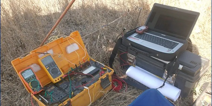
Methodology and scope
Local considerations
Chandler sits at an elevation of about 370 m with a semi-arid climate and average annual rainfall under 250 mm. That aridity creates a deep vadose zone where soil resistivity can be extremely high — often exceeding 500 ohm-m in the upper 2 m. The risk is that a contractor interprets high resistivity as dry sand suitable for shallow footings, only to find a caliche layer at 4 m that requires blasting or over-excavation. We have mapped caliche at depths between 3 and 6 m across multiple subdivisions in Chandler, particularly near the southern edge of town where the Salt River alluvial fan transitions to older basin deposits. Without a resistivity survey, that caliche stays hidden until the excavator teeth hit it. The cost of mobilizing a rock hammer mid-project far exceeds the cost of the geophysical survey.
Applicable standards
ASTM D6431-18 (Standard Guide for Using the Direct Current Resistivity Method for Subsurface Investigation), ASTM D5777-18 (Standard Guide for Using the Seismic Refraction Method for Subsurface Investigation, referenced for complementary surveys), ASCE 7-22 Section 11.4 (Site Class determination, used alongside VES for soil profile identification)
Associated technical services
2D Electrical Resistivity Tomography (ERT)
A continuous imaging profile using 48 electrodes along a straight line. The inverted cross-section shows resistivity variations in color scale, making it easy to identify stratigraphic boundaries, clay lenses, and groundwater. Ideal for large residential subdivisions or commercial pads in Chandler where the subsurface varies laterally.
Vertical Electrical Sounding (VES) – 1D Point Soundings
A quick, cost-effective method using four electrodes expanded symmetrically from a central point. VES provides a 1D resistivity-depth curve at that location. We use it for small lots, single-family homes, or preliminary screening before deploying a full ERT profile. Each VES takes about 20 minutes in the field.
Typical parameters
Frequently asked questions
How deep can the resistivity survey reach in Chandler soils?
With a 48-electrode array and 5 m spacing, we achieve reliable readings down to 25–30 m. In the dry upper layer of Chandler, the injected current spreads easily, so depth is rarely a limitation for residential projects.
What is the difference between electrical resistivity and electromagnetic induction (EM) methods?
Resistivity uses galvanic contact through electrodes, giving higher resolution in the shallow zone (0–30 m). EM methods are faster but have lower vertical resolution and can be affected by buried metal pipes or fences common in Chandler subdivisions. We prefer resistivity for stratified alluvial profiles.
Can resistivity detect groundwater in Chandler?
Yes. Fresh groundwater typically appears as a sharp drop in resistivity below 30 ohm-m. In Chandler, the water table is generally at 30 to 60 m depth in the main aquifer, but perched zones can occur above caliche layers at shallower depths. Resistivity can identify these perched zones before excavation.
How much does a resistivity survey cost for a typical Chandler lot?
The price range for a standard VES or ERT survey in Chandler is between US$610 and US$1,050, depending on the number of profiles and depth required. A single VES point for a small home lot is at the lower end; a 2D ERT profile across a large subdivision is at the higher end.
Do you need access to both sides of the profile line?
Not necessarily. For a Wenner array, we only need a straight line of about 60 to 100 m. As long as the land is accessible and clear of major obstructions (buildings, heavy vegetation), we can set up. In Chandler, most vacant lots are flat and open, so access is rarely an issue.